The UK Logistics Network
Client : Logistics UK
Date: 2024
To map the current state of the UK’s logistics corridors, focusing on key road and rail routes and how they connect ports, airports, urban and industrial centres and therefore define the UK Logistics Network.
The Question
How are regions of the UK connected, what are they key road and rail routes, and what are the pinch points which limit the efficiency of the flow of goods and therefore the productivity of the economy? How should the UK Logistics Network be defined?
The Solution
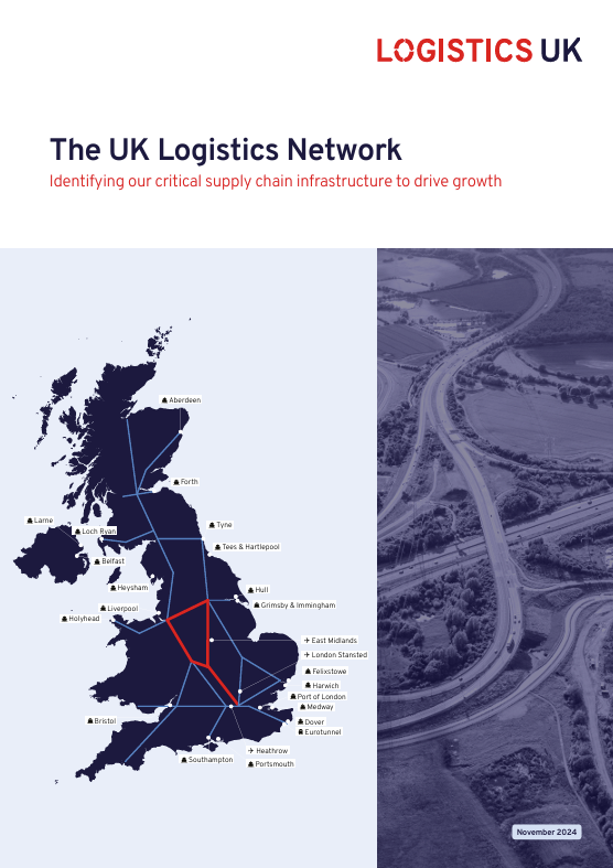
MDST identified key freight routes and produced maps to define the UK logistics corridors, including:
- Key road routes for freight, informed by the Department for Transport’s average annual daily flow (AADF) data;
- Key rail routes for freight, informed by Network Rail traffic data;
- Principal ports in the freight network;
- Road traffic growth and congestion;
- Forecast rail traffic growth and congestion;
- Regional key road freight routes, informed by data from the Great Britain Freight Model (GBFM) and the Department for Transport’s AADF.
Achievements
A report was published by Logistics UK titled “The UK Logistics Network: Identifying our critical supply chain infrastructure to drive growth” and is available on their website.
Link: https://logistics.org.uk/research-hub/reports/uk-logistics-network